
Cloud-Based (PaaS) Spatial Information Development Platform
We widely distribute our self-developed spatial information platform to the public
and private sectors to enable anyone to easily build spatial information services.
and private sectors to enable anyone to easily build spatial information services.

- Provides a stable quality and technology environment.
-
Wavus geospatial platforms, GeOnPaaS (2D) and GeOnDT (3D), provide customized tools
that enable anyone to build complex map services quickly and easily.
In addition, by integrating the AI-powered solution GeOnAI, vast amounts of institutional
documents and image data can be transformed into an intelligent knowledge system,
dramatically improving operational efficiency.
-
 01PaaS Cloud
Technology base -
 02Modularization of common
spatial information
development components -
 03AI-driven Innovation
in Work Efficiency
Main Features
-

- GIS Framework
- Easy utilization of GIS core functions such as OGC standards, spatial analysis, spatial operations, information management, and search.
-

- ODF (Development SDK)
- Provision of APIs for web service development, including map control, map management, and information convergence.
-

- Authoring Tool
- Easy-to-use UI for creating and editing maps (thematic maps) or screens (web applications) directly on the web.
-

- GeoAI
- Supports the automated collection, processing, and analysis of geospatial information through AI agent-based natural language queries.
Application Examples
-
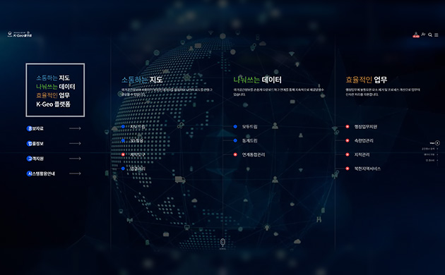
Ministry of Land, Infrastructure and Transport
- K-GEO Platform
- Establishing a platform-based utilization system that provides map creation environments and data to enable anyone to easily utilize national spatial information.
-
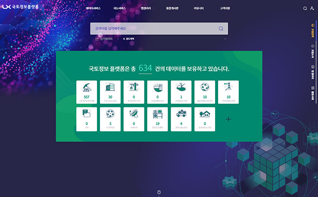
LX (Korea Land and Spatial Informatix Corporation)
- LX Land Information Platform
- Establishment of a spatial information data dam that facilitates the easy integration and utilization of LX and other agencies' spatial information and administrative information.
-
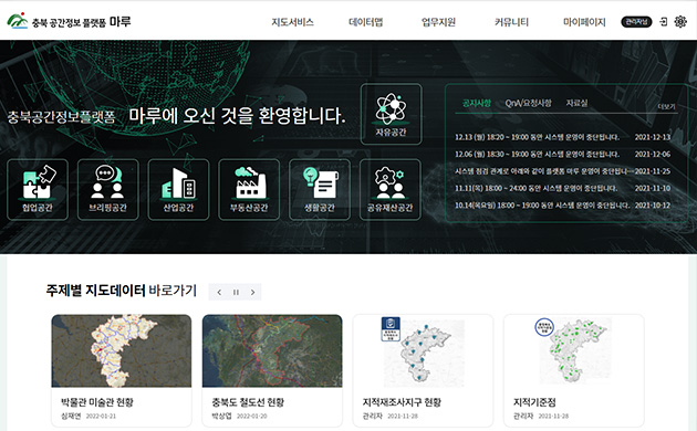
Chungbuk Province·LX
- Smart Chungbuk Spatial Information Platform
- Establishment of a local spatial administration platform for spatial information-based data administration support as a leading example of collaboration between public agencies and local governments.
Major References
| Construction of a spatial information data integration and convergence utilization system based on the cloud | 2020 ~ present | Korea Information Society Agency |
| Construction of a spatial platform for communication administration based on spatial information in Gyeongsan City | 2019 ~ 2021 | Gyeongsan City, North Gyeongsang Province |
| Construction of a smart Chungbuk spatial information platform | 2020 ~ present | Chungcheongbuk-do |
| Construction of a smart spatial information platform | 2021 ~ present | Gyeongsangnam-do |
| LX integrated business platform construction (Phase 1) service | 2021 ~ present | Korea Land and Spatial Information Corporation |
| LX national land information platform construction project (Phase 1) service | 2021 ~ present |